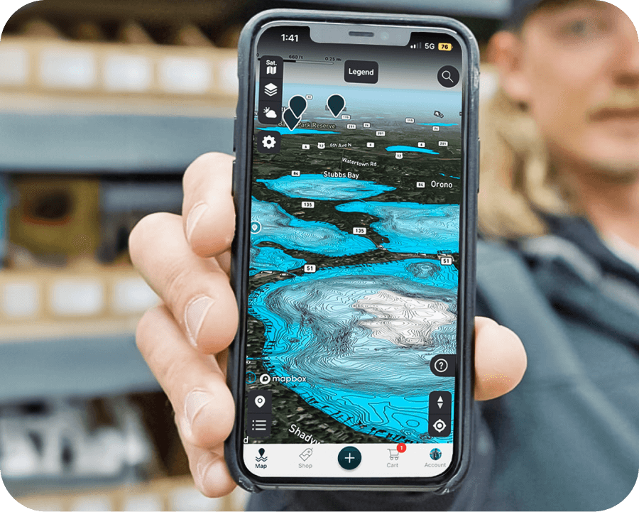
Omnia PRO Advanced Mapping Tools
About Omnia Fishing
Omnia Fishing is the first e-commerce company that personalizes the shopping experience for anglers, organizing products and recommendations based on the specific water bodies and conditions they fish. With an index of over 100,000 water bodies in North America, Omnia combines reports from local anglers with real-time data on weather, water and environmental conditions to suggest the best gear and techniques.
Problem
Planning a fishing trip can be overwhelming, especially for anglers of different experience levels. Information is scattered across multiple sources, and advice often depends on specific factors like location, weather, and water conditions. Beginners may struggle to find clear guidance, while advanced anglers need detailed, real-time data to make informed decisions. This fragmented information creates a challenging and time-consuming planning process.
Key Challenges
- Geological Variations: Each location offers unique conditions, making it difficult to generalize fishing advice.
- Dynamic Conditions: Weather and water conditions, like clarity and temperature, are crucial but hard to track.
- Varying Experience Levels: Novices need simple advice, while experts require precise, detailed information.
- Fragmented Data: Fishing knowledge is scattered, making it difficult to plan efficiently.
- User Accessibility: The platform must be intuitive for users at all levels of expertise.
Solution
To address these challenges, Omnia Fishing developed a personalized mapping platform that simplifies trip planning by consolidating all relevant data in one place. The platform organizes information by specific water bodies, providing real-time updates on weather, water conditions, and local reports. Anglers of all levels can easily navigate the platform to get location-based gear recommendations and trip advice. We set out to create a core set of map layers to begin with and then enrich the experience by adding new layers over time. We called it Omnia PRO.
Omnia PRO's solution would turn complex, scattered data into a seamless, user-friendly experience, making fishing trip planning easier and more effective for everyone.
The Goals
- Replicate the in-store service of a Bass Pro, Cabelas, or local bait shop, but online and accessible to anybody.
- Make good tackle and travel plan recommendations; contextualized to the consumer.
- Serve varied levels of anglers with different ecommerce goals.
- Streamline and grow ecommerce: Selling tackle.
- Accelerate the collection of user generated content in the form of fishing reports.
Design Process
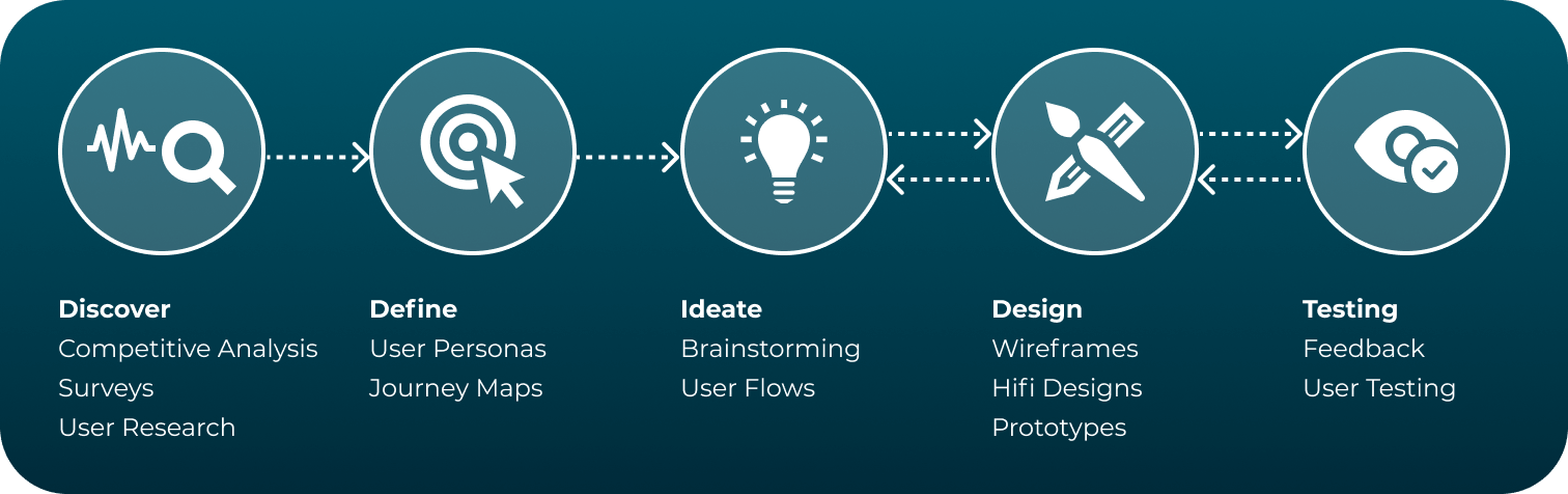
Discover Phase
In the Discover phase, we used competitive analysis, interviews, and surveys to understand the market and what users actually need. This research helps identify key features, user expectations, and ensures that solutions are based on evidence, not assumptions.
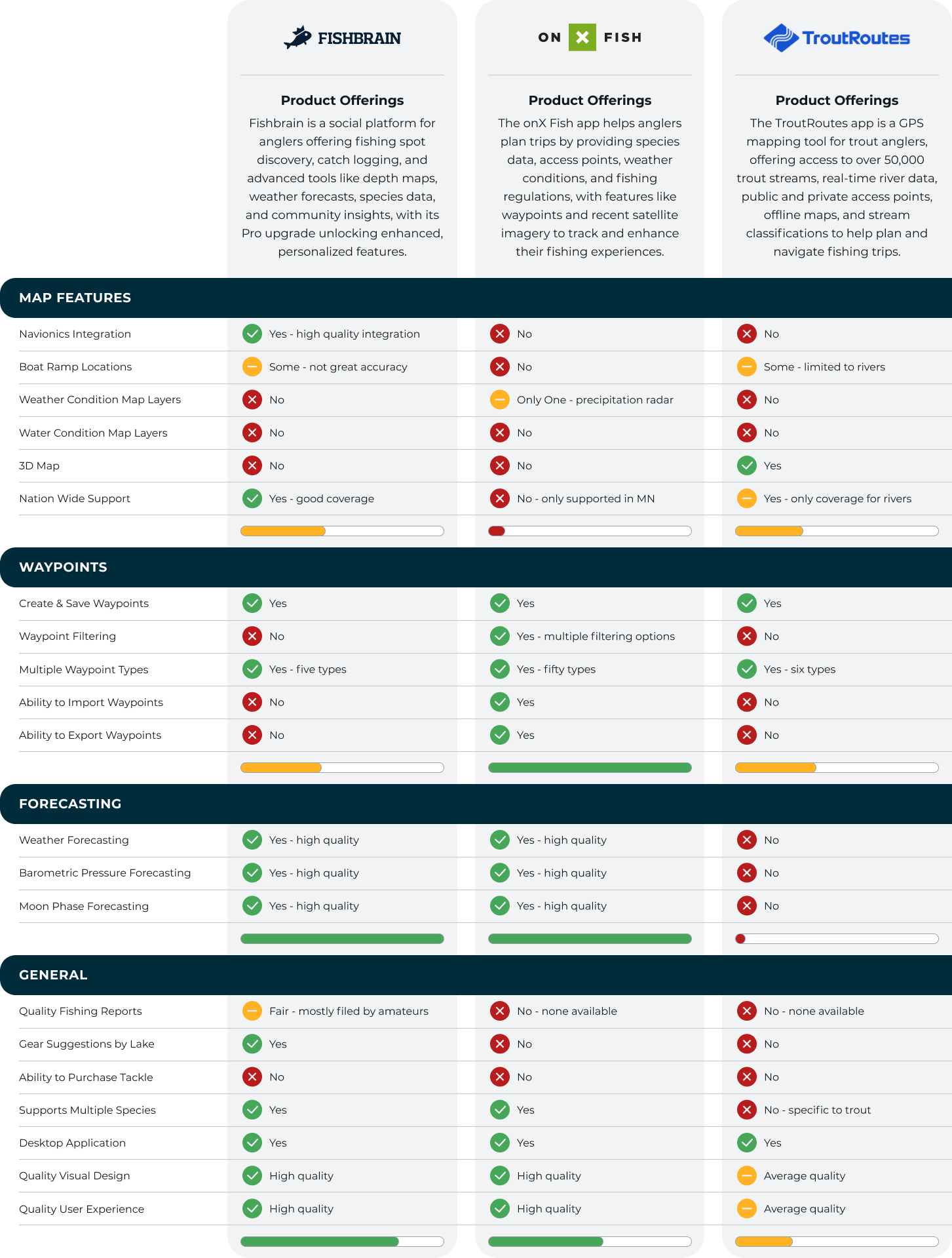
Competitive Analysis
We identified the top three competitors and examined their features, user flows, and overall experience. This helped us determine which core features to prioritize for our minimum viable product and ensured we were aligned with user expectations from the start.
Interviews
We conducted interviews to several people based on chosen customer segmentation. Here are a few of the questions that were asked:
- What are your suggestions for how we can improve at Omnia?
- What features do you find most useful in a map when planning your fishing trip?
- Do you have any suggestions for improving the usability of these map features?
- In your own words, describe the ideal mobile app involving map layers that would help you have more success on the water.
- If you had access to all of the map layers described in the previous question, how would you use the information to improve your chances for success?
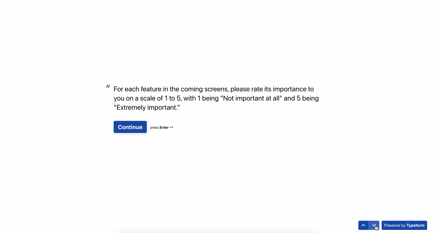
Survey
We conducted a survey to several people based on chosen customer segmentation. Here are the questions that were asked:
- For each feature in the coming screens, please rate its importance to you on a scale of 1 to 5, with 1 being "Not important at all" and 5 being "Extremely important".
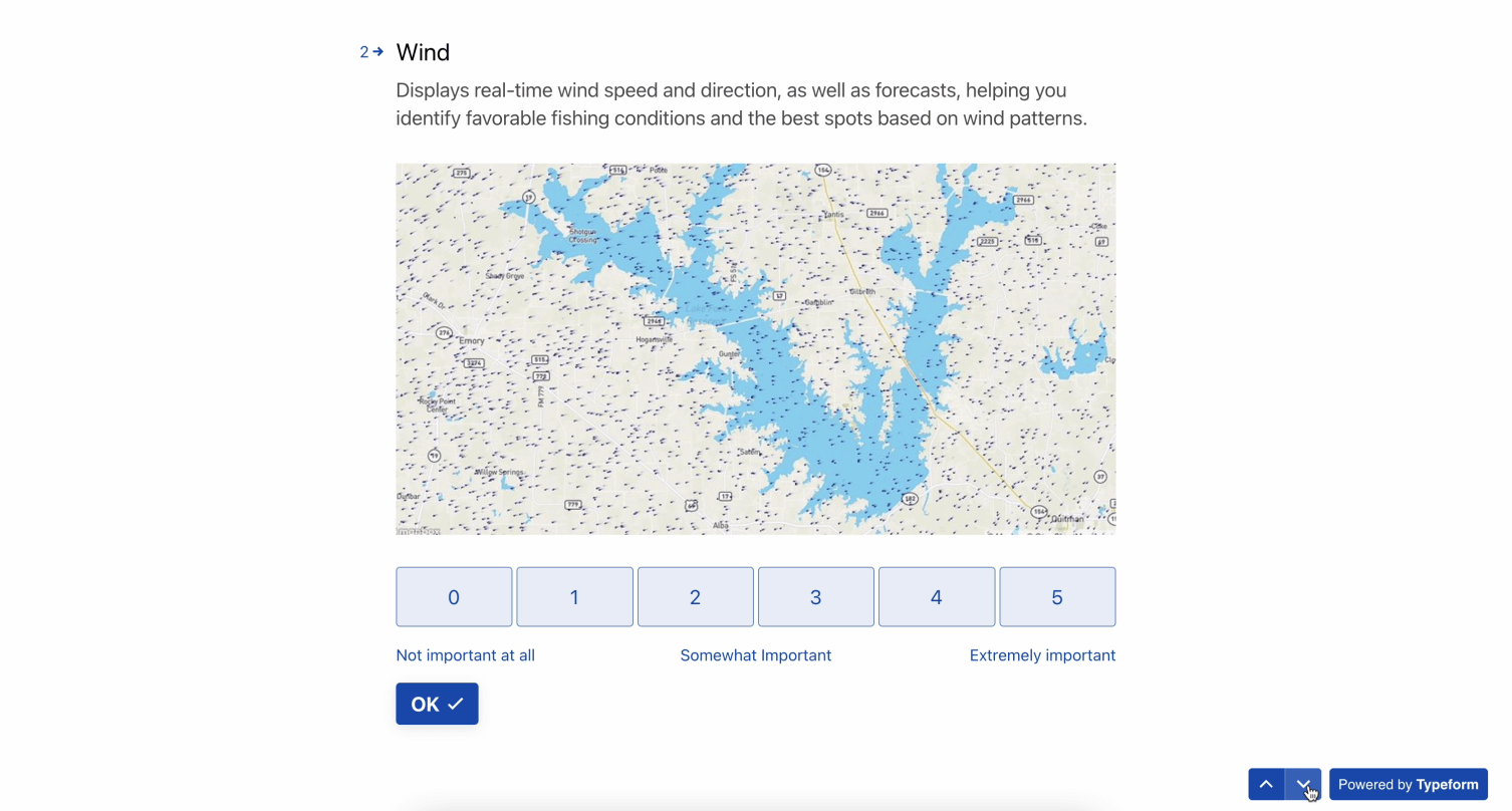
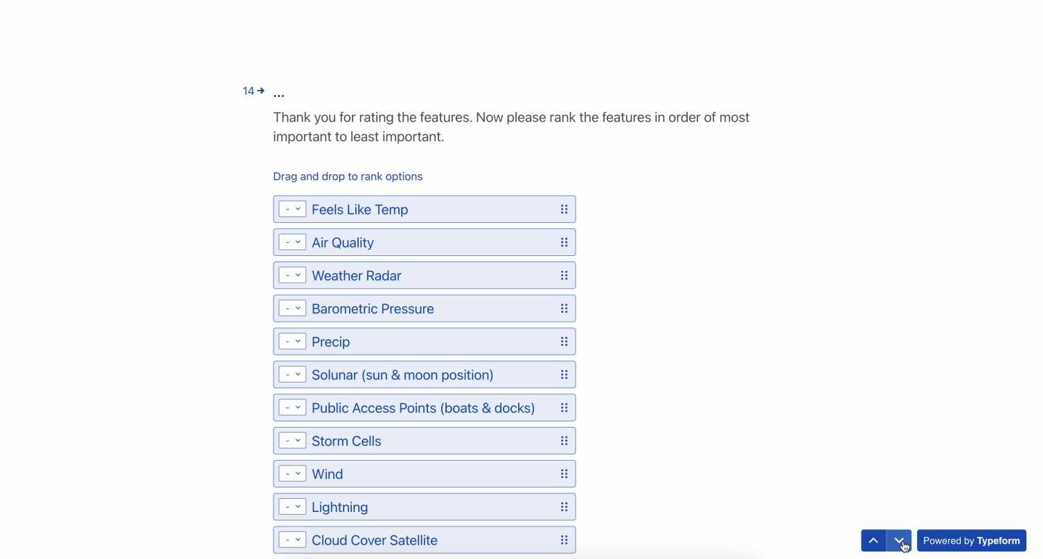
- Wind - Displays real-time wind speed and direction, as well as forecasts, helping you identify favorable fishing conditions and the best spots based on wind patterns (0 – 5 scale).
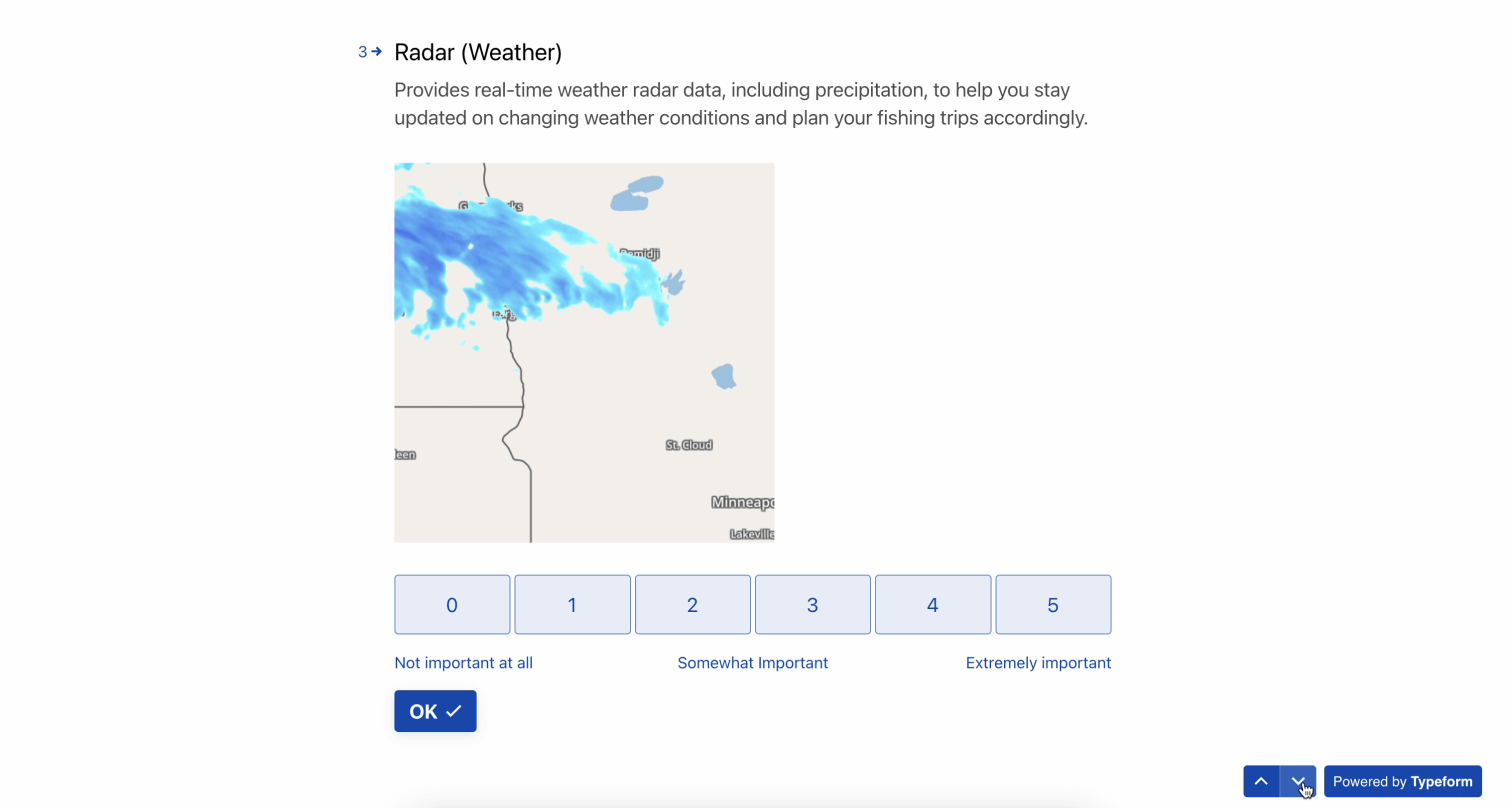
- Radar (Weather) - Provides real-time weather radar data, including precipitation, to help you stay updated on changing weather conditions and plan your fishing trips accordingly (0 – 5 scale).
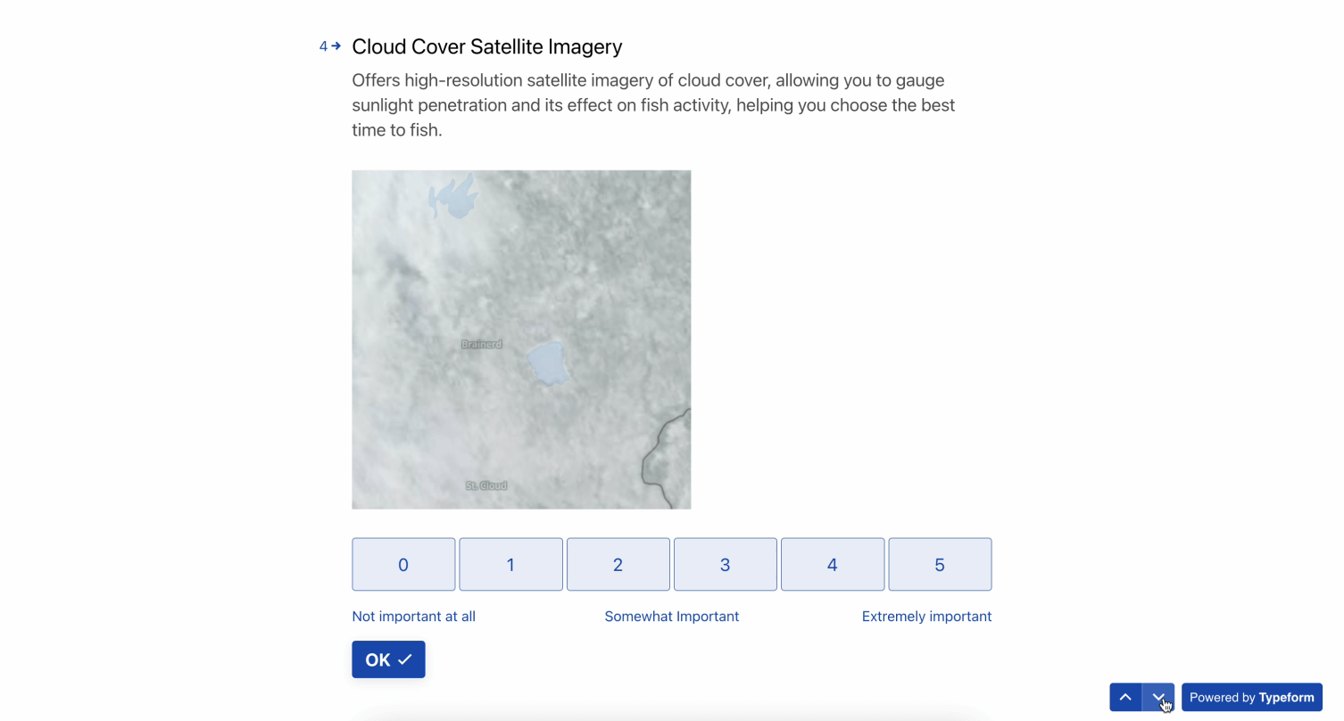
- Cloud Cover Satellite Imagery - Offers high-resolution satellite imagery of cloud cover, allowing you to gauge sunlight penetration and its effect on fish activity, helping you choose the best time to fish (0 – 5 scale).
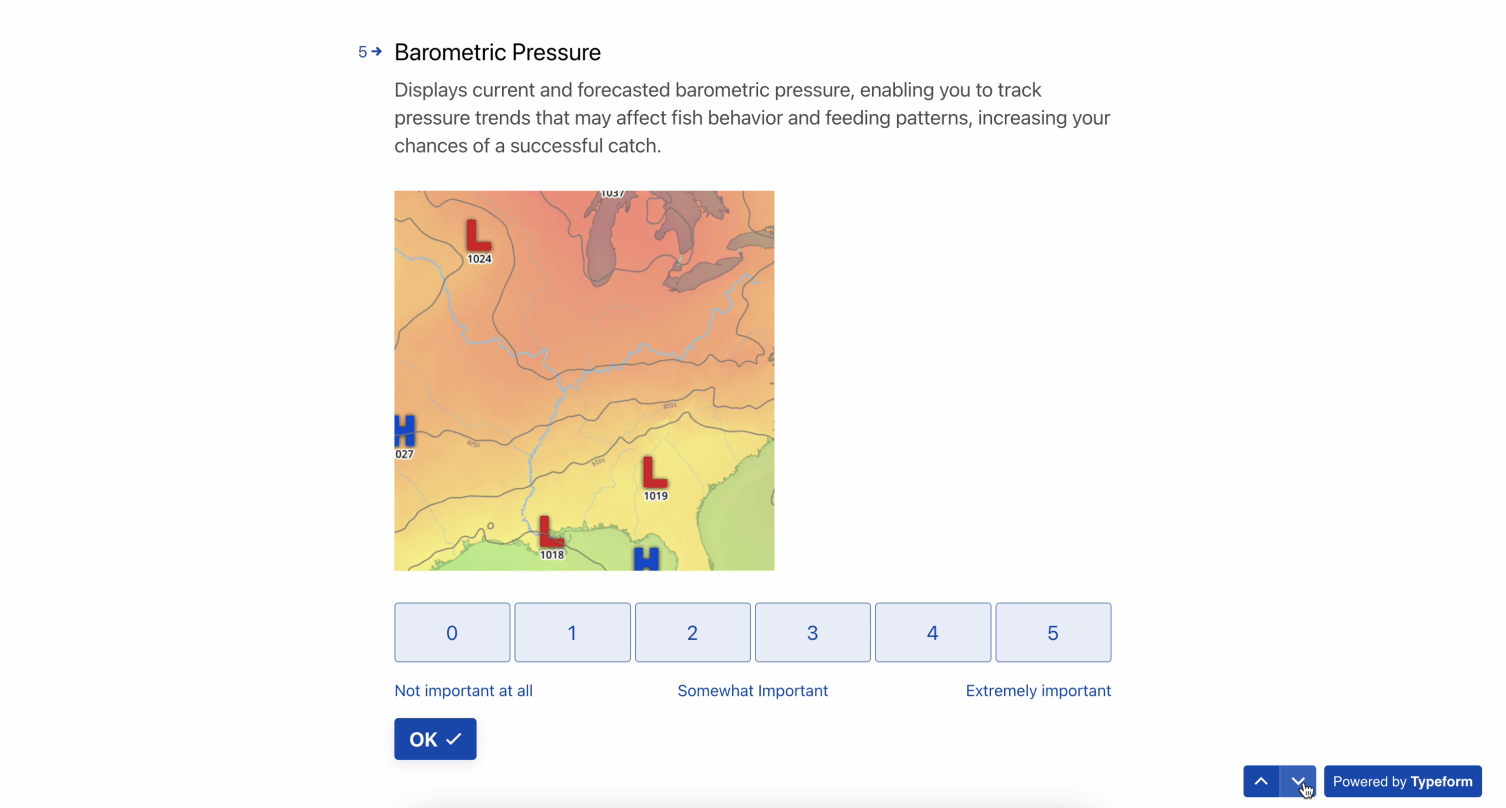
- Barometric Pressure - Displays current and forecasted barometric pressure, enabling you to track pressure trends that may affect fish behavior and feeding patterns, increasing your chances of a successful catch (0 – 5 scale).
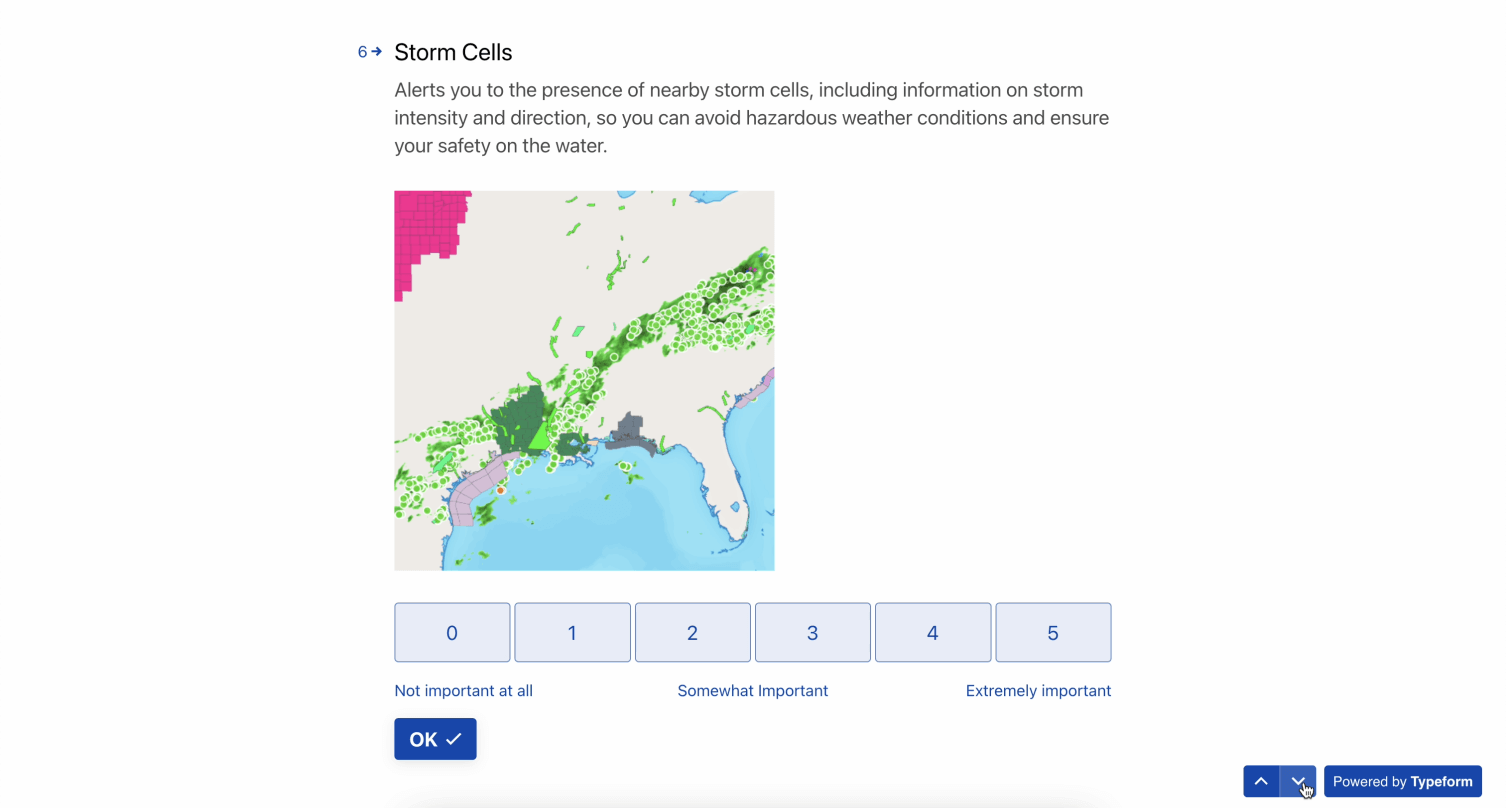
- Storm Cells - Alerts you to the presence of nearby storm cells, including information on storm intensity and direction, so you can avoid hazardous weather conditions and ensure your safety on the water (0 – 5 scale).
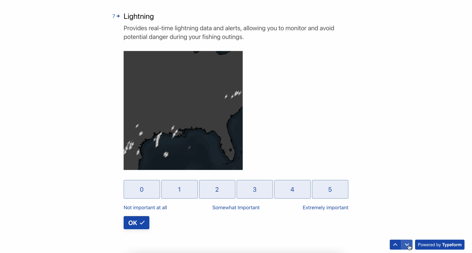
- Lightning - Provides real-time lightning data and alerts, allowing you to monitor and avoid potential danger during your fishing outings (0 – 5 scale).
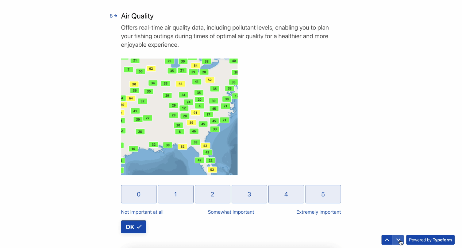
- Air Quality - Offers real-time air quality data, including pollutant levels, enabling you to plan your fishing outings during times of optimal air quality for a healthier and more enjoyable experience (0 – 5 scale).
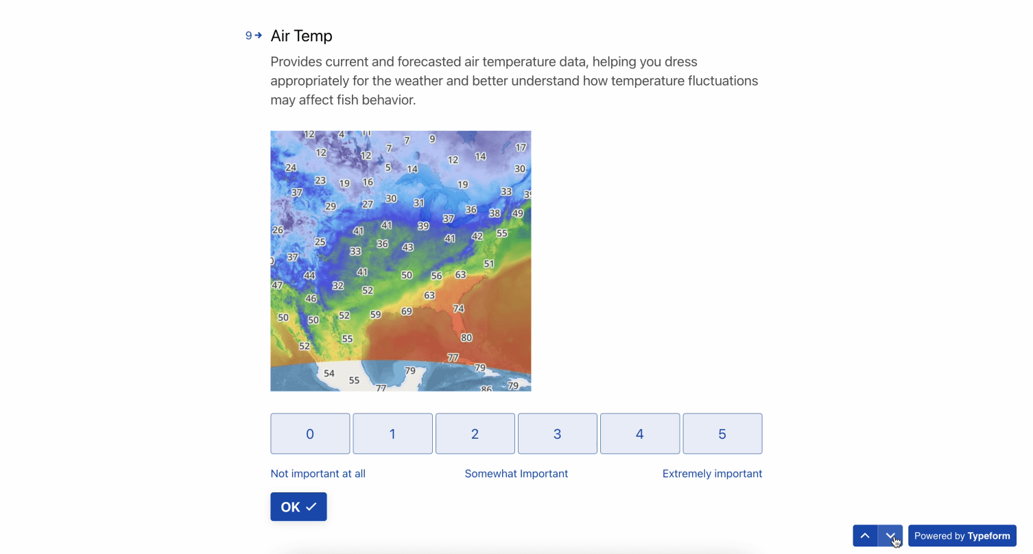
- Air Temp - Provides current and forecasted air temperature data, helping you dress appropriately for the weather and better understand how temperature fluctuations may affect fish behavior (0 – 5 scale).
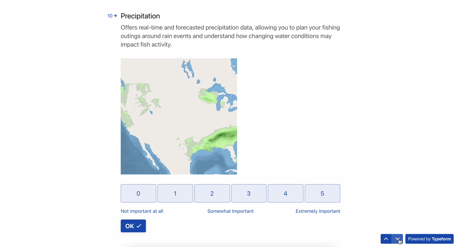
- Precipitation - Offers real-time and forecasted precipitation data, allowing you to plan your fishing outings around rain events and understand how changing water conditions may impact fish activity (0 – 5 scale).
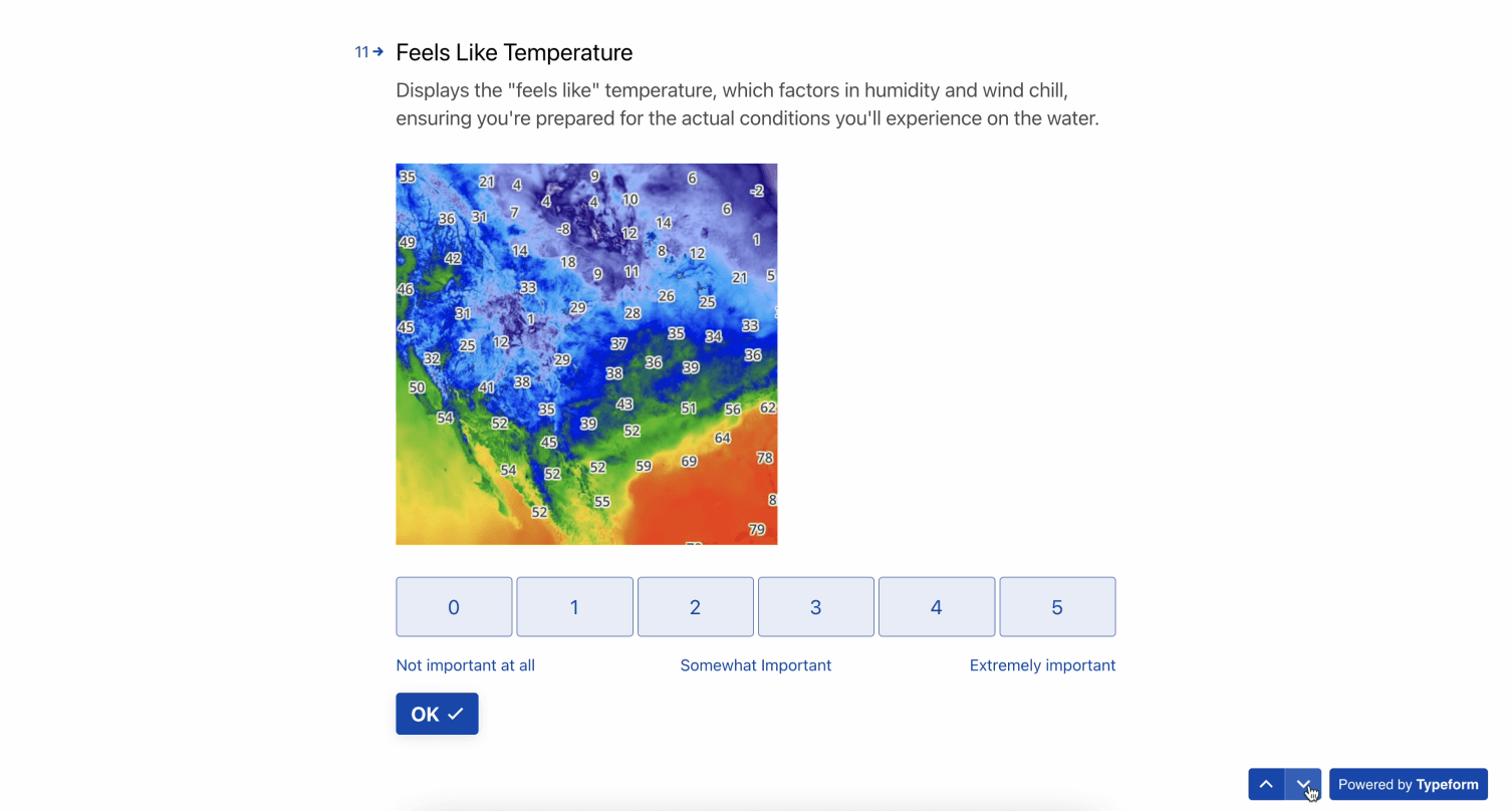
- Feels Like Temperature - Displays the "feels like" temperature, which factors in humidity and wind chill, ensuring you're prepared for the actual conditions you'll experience on the water (0 – 5 scale).
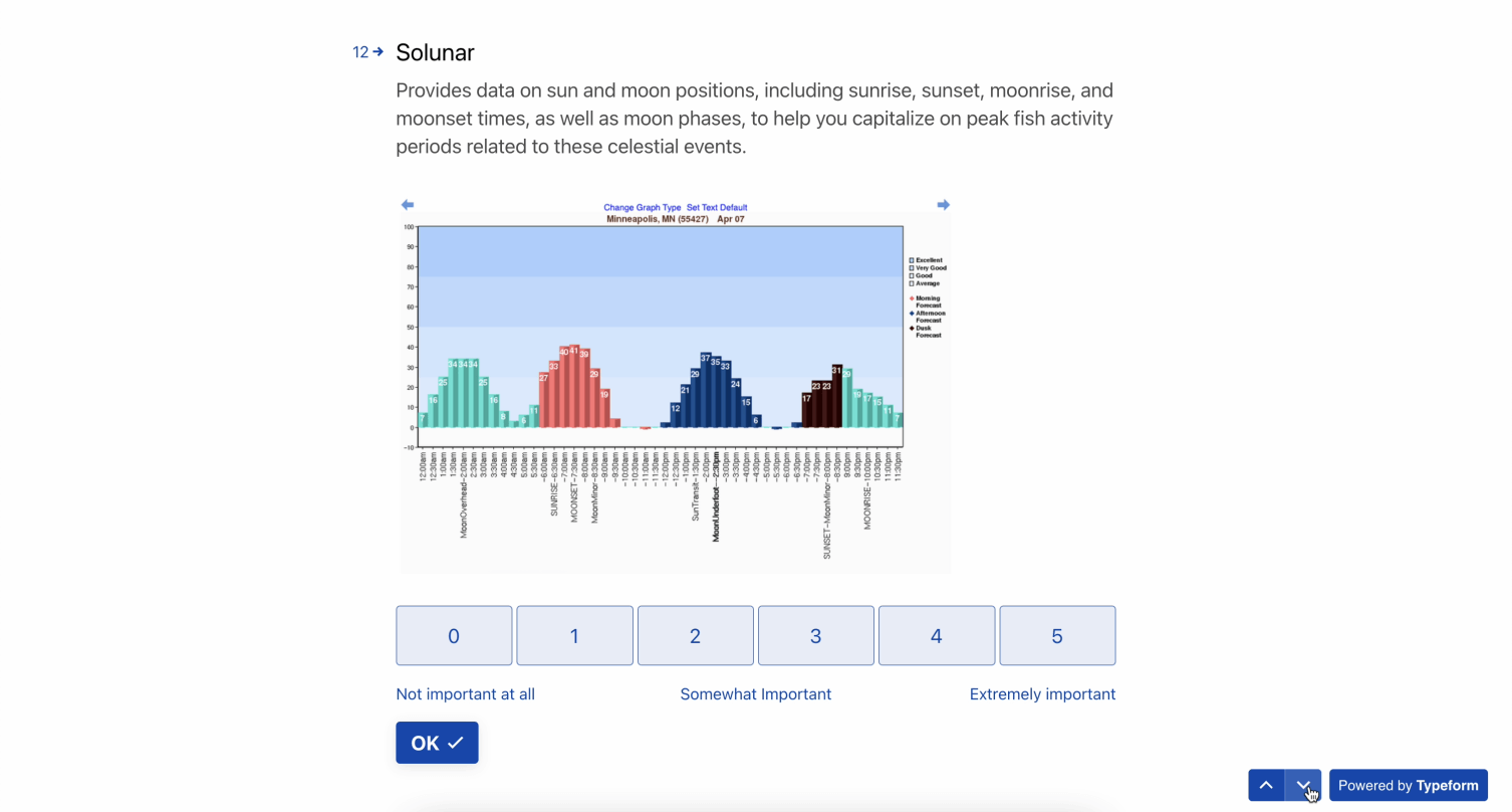
- Solunar - Provides data on sun and moon positions, including sunrise, moonrise, and moonset times, as well as moon phases, to help you capitalize on peak fish activity periods related to these celestial events (0 – 5 scale).
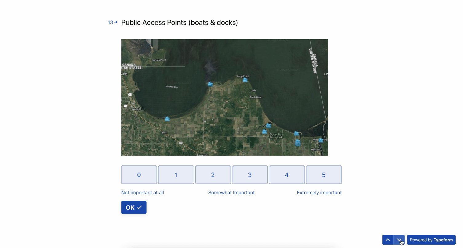
- Public Access Points (boats & docks) - Provides information on where boat ramps are located so you can plan your launch point (0 – 5 scale).
- Thank you for rating these features. Now please rank the features in order of most important to least important.
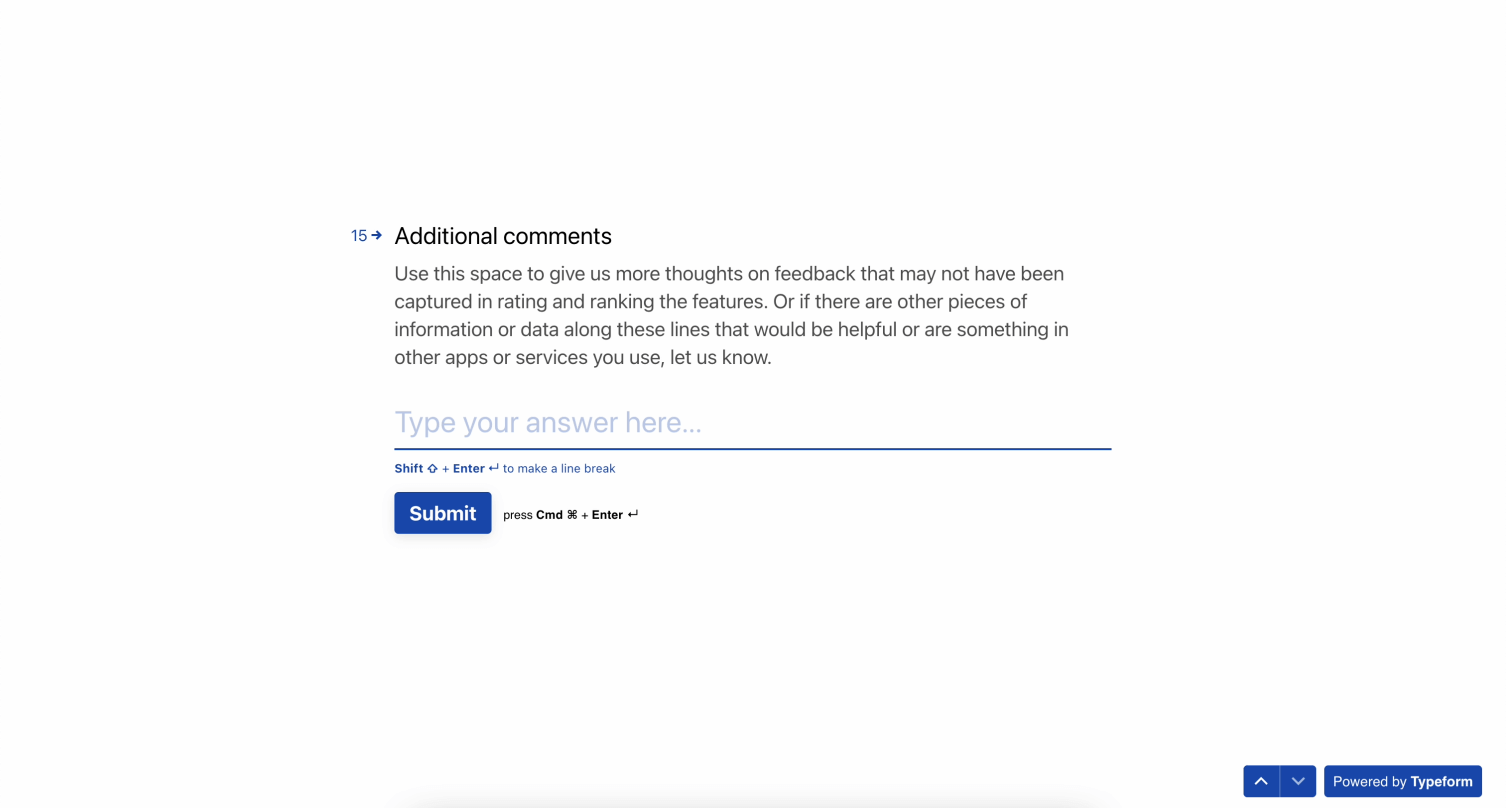
- Additional Comments - Use this space to give us more thoughts on feedback that may not have been captured in rating and ranking the features. Or if there are other pieces of information or data along these lines that would be helpful or are something in other apps or servies you use, let us know.
Define Phase
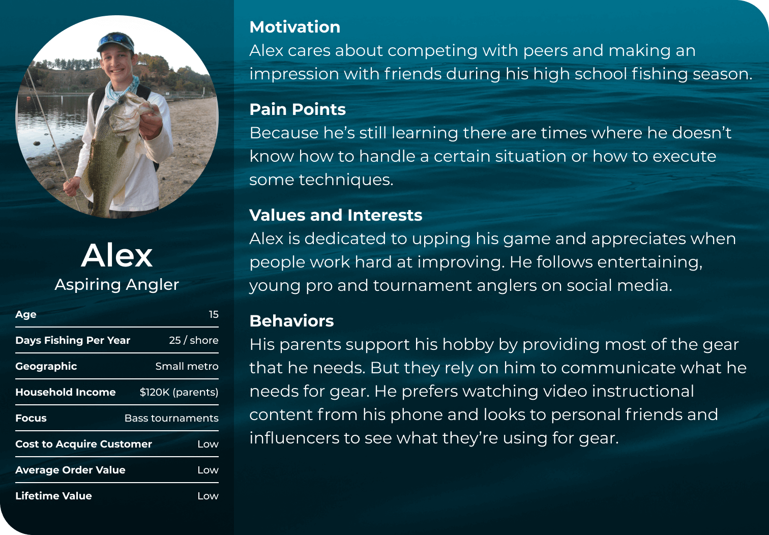
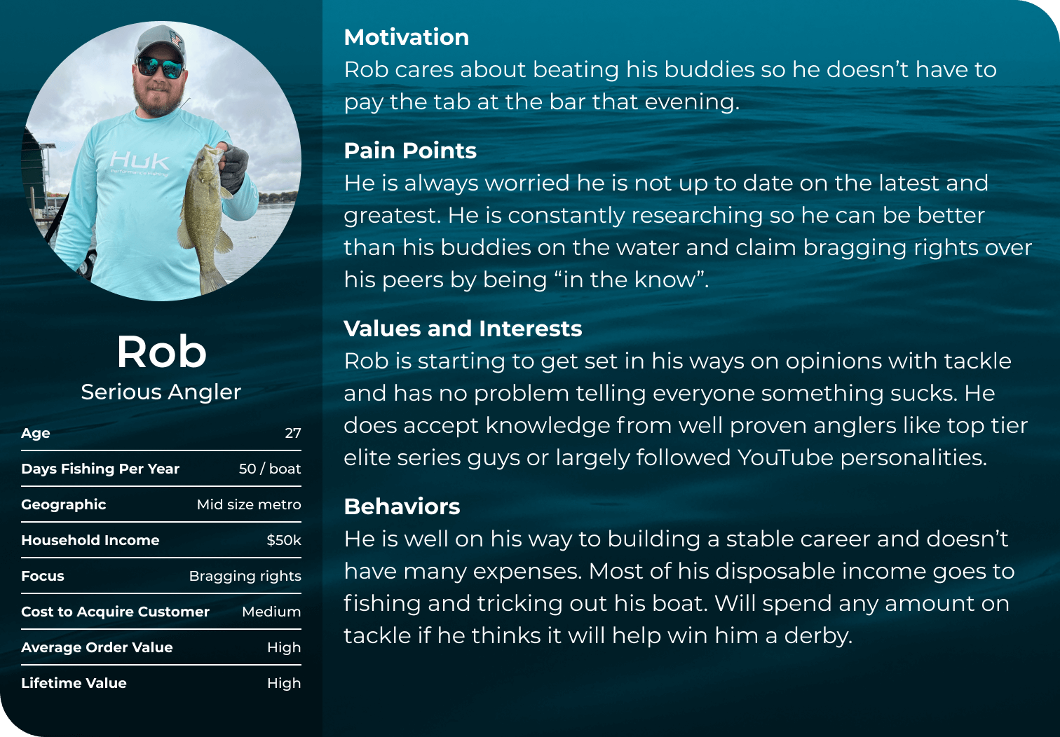
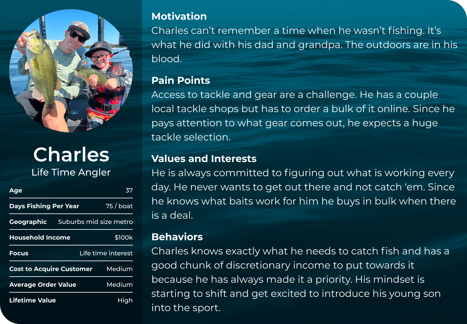
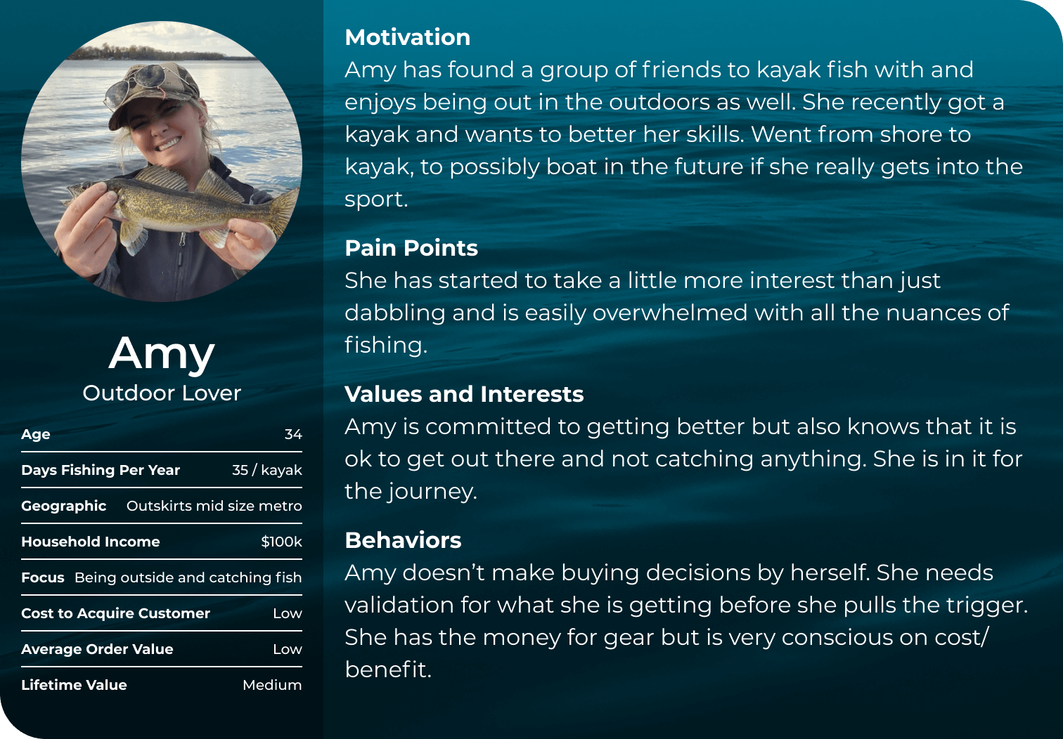
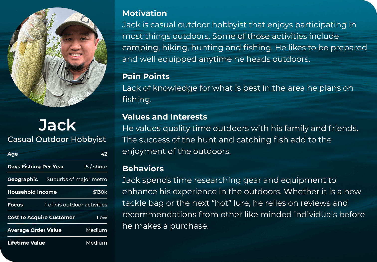
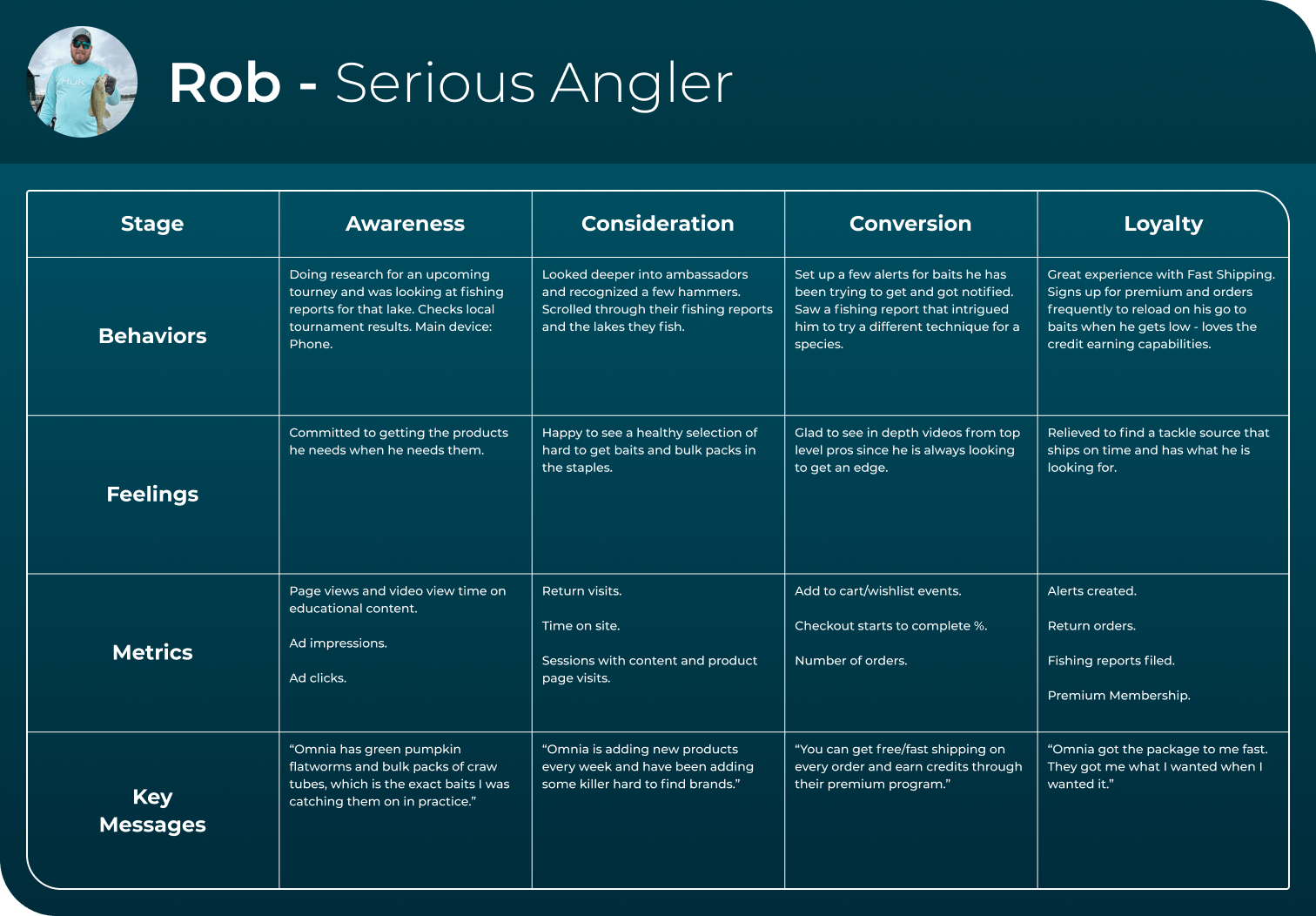
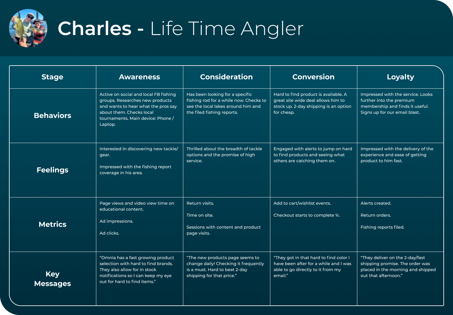
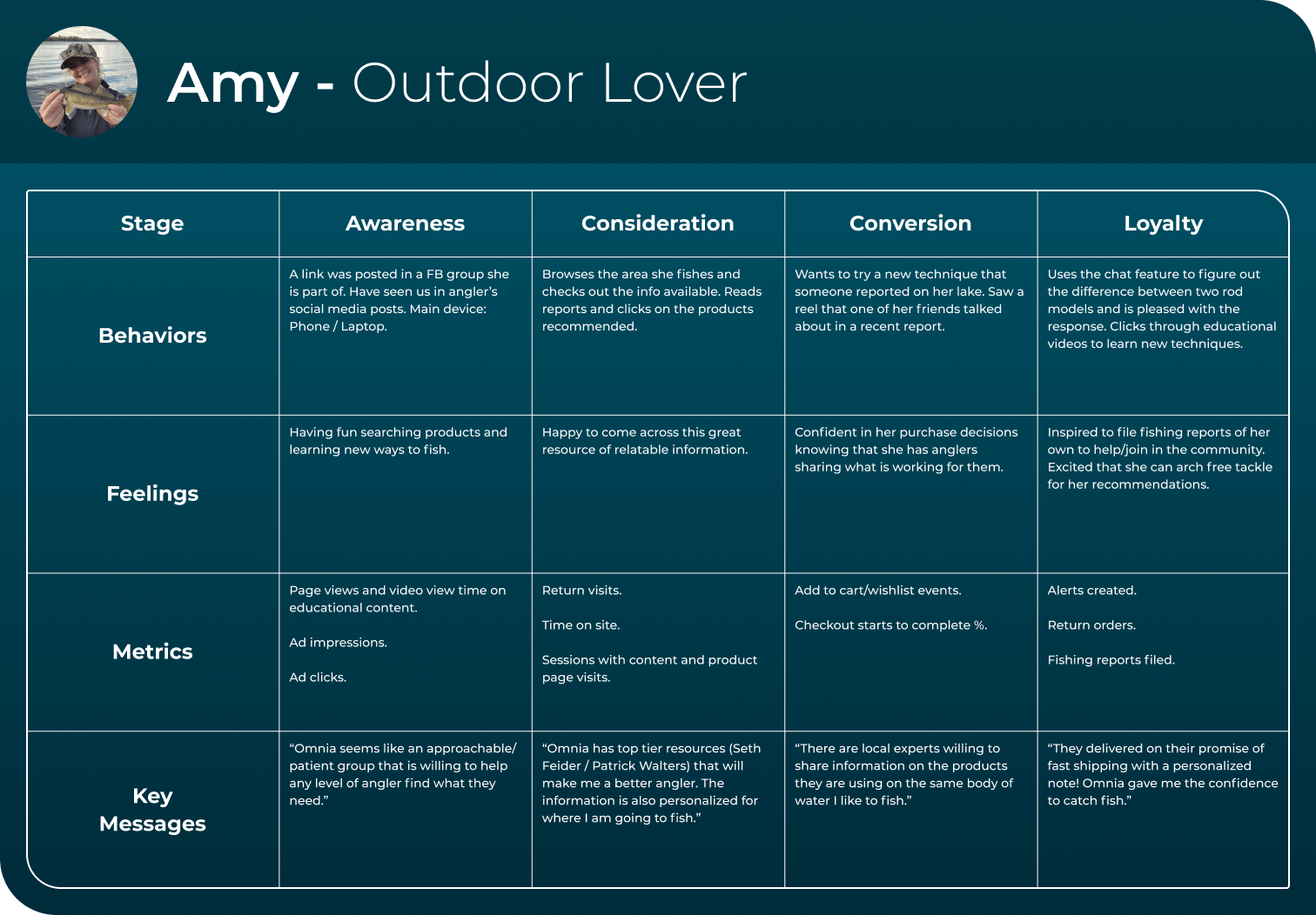
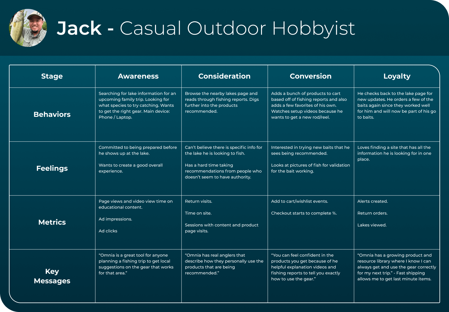
Persona Development
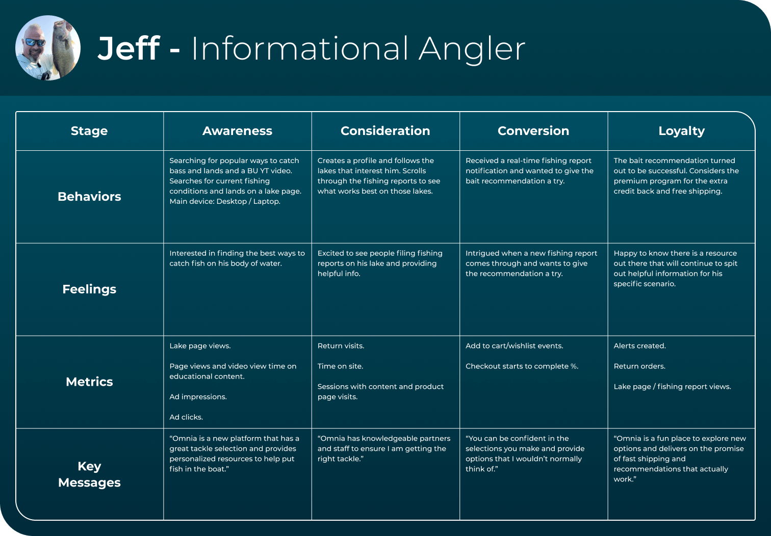
Here are some user personas created based on information gathered in the prior phase.

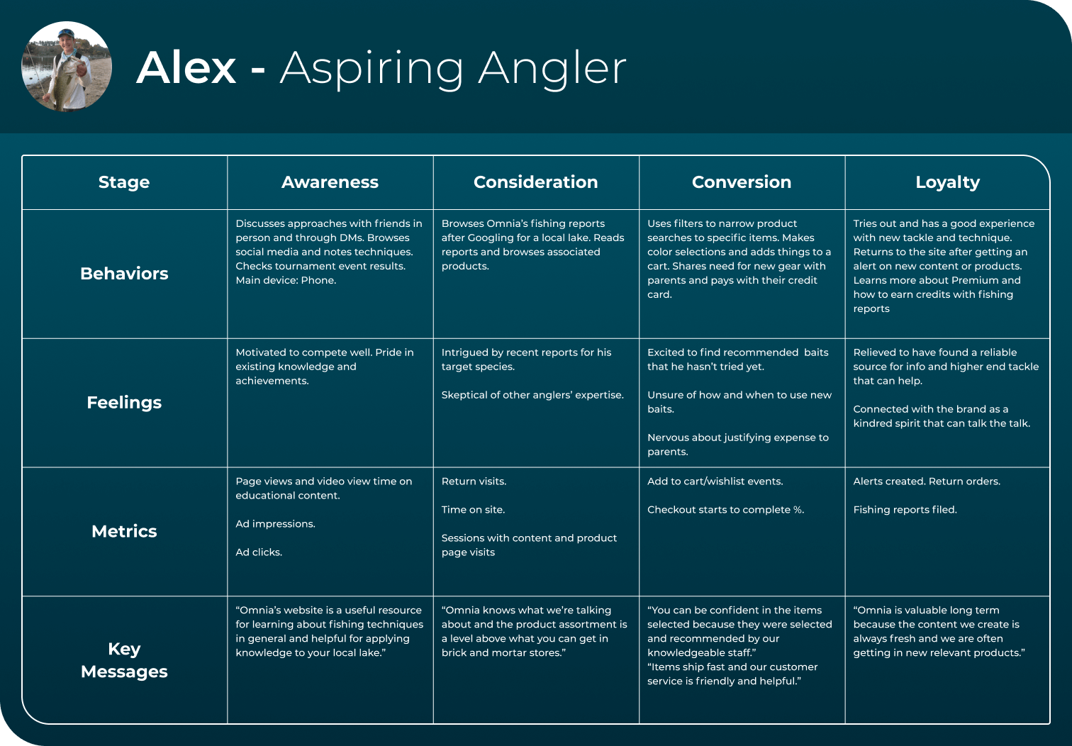
Customer Journeys
Here are some customer journey maps created to gain a deeper understanding of user interactions and pain points throughout the experience. This allowed us to identify key opportunities for improvement and create a more seamless, user-centered solution that addressed their needs effectively.
Ideate Phase
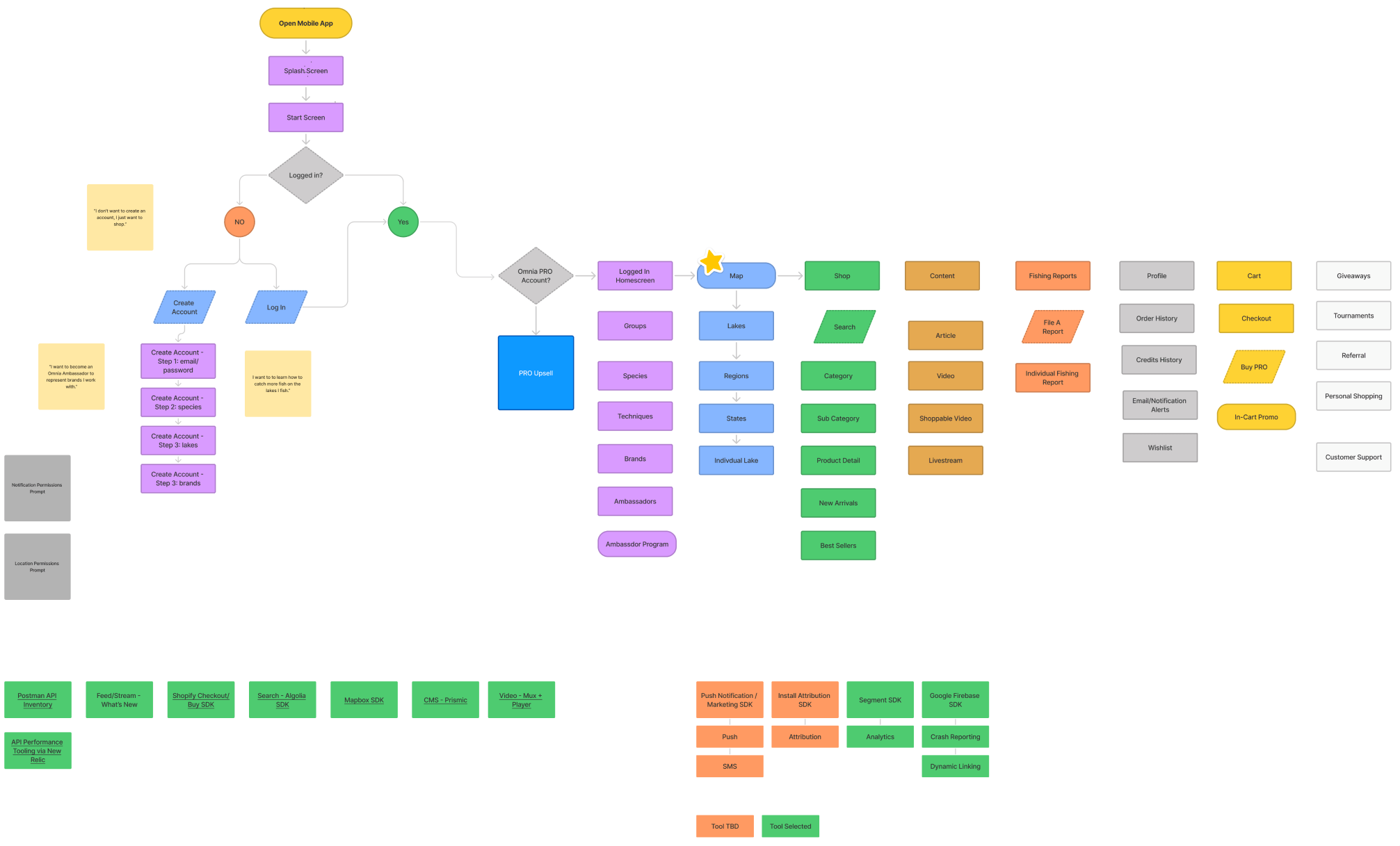
User Flow
User flow is the path taken by a prototypical user on a website or app to complete a task. The user flow takes them from their entry point through a set of steps towards a successful outcome and final action, such as purchasing a product.
Design Phase
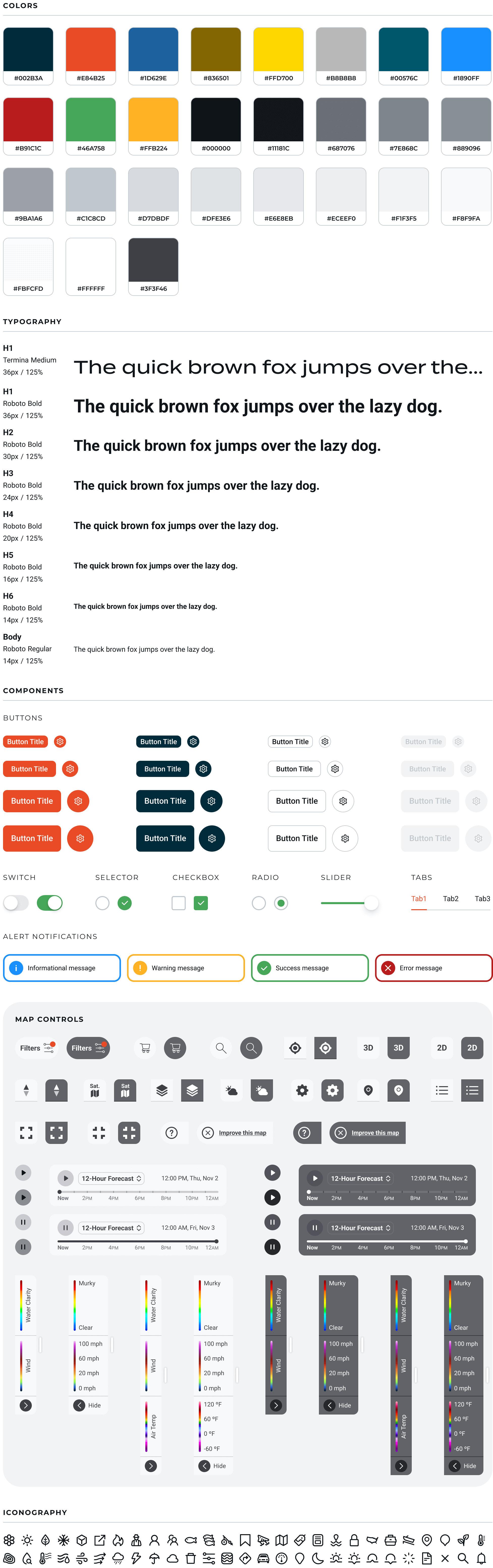
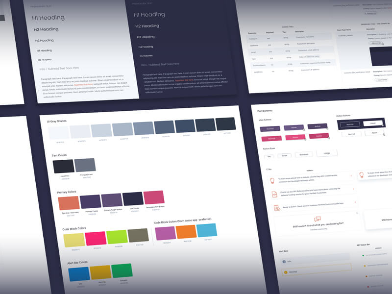
Design System
To maintain consistency and streamline development, we implemented a design system using the Tamagui React Native style library. Standardized components and guidelines helped improve collaboration, speed up the build process, and ensure a cohesive user experience with predictable, high-quality interactions.
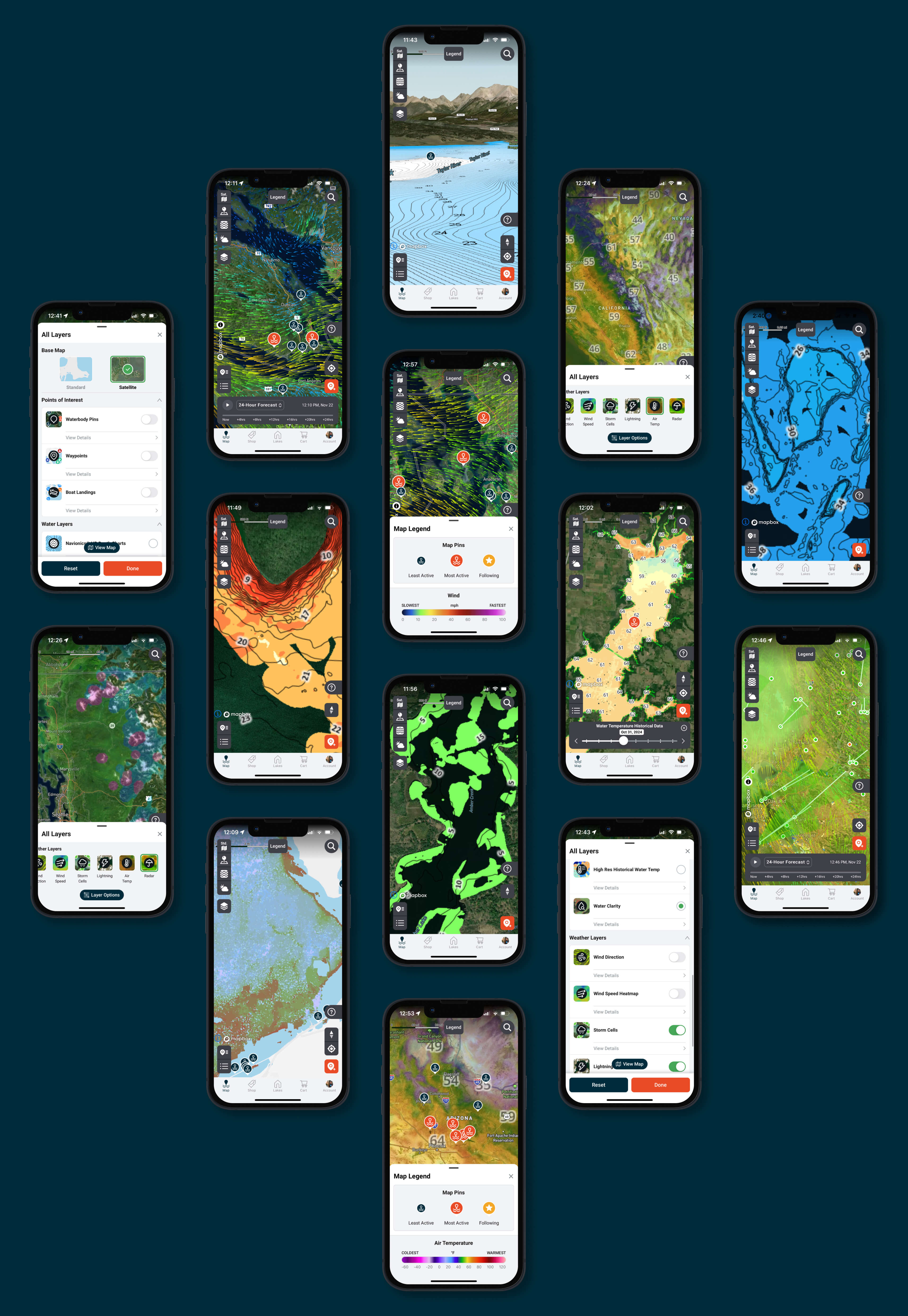
Map Layers
We implemented a variety of map layers to help anglers plan smarter and fish more effectively. With depth contours, water clarity, vegetation, and bottom composition, users get a detailed view of underwater conditions. These insights make it easier to find key spots, track seasonal patterns, and make informed decisions—boosting success whether exploring new lakes or refining tactics on familiar waters.

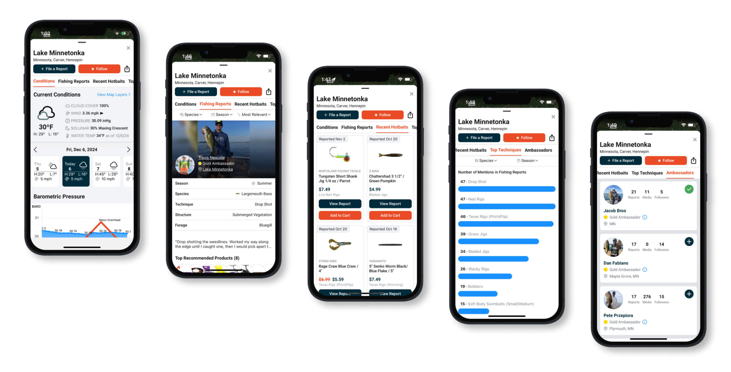
Lake Details
With access to a database of over 100K waterbodies, anglers can explore detailed information for each lake. This includes 20,000+ fishing reports, showcasing what’s working right now from other anglers. Each lake features a breakdown of popular baits, best sizes/colors, and top techniques. You can also view key conditions like species present, weather, solunar forecasts, barometric pressure, and more.
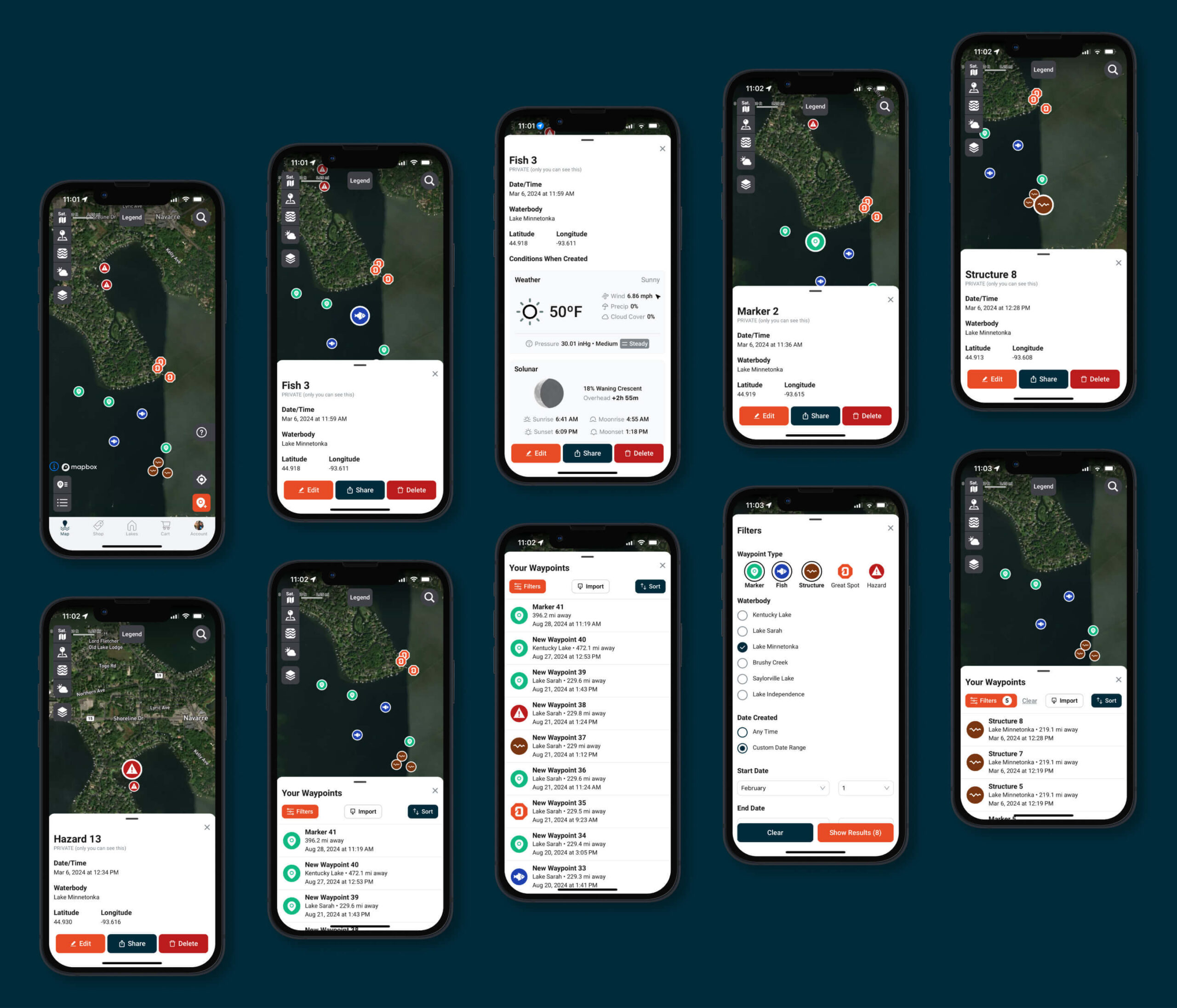
Waypoints
The waypoint management system gives anglers powerful tools to mark, track, and refine their fishing spots. Users can drop custom waypoints—like markers for structure, fish, great spots, or hazards—and track conditions over time. With weather tracking, filtering, and location sharing, it helps both casual and pro users plan and execute more effective trips.
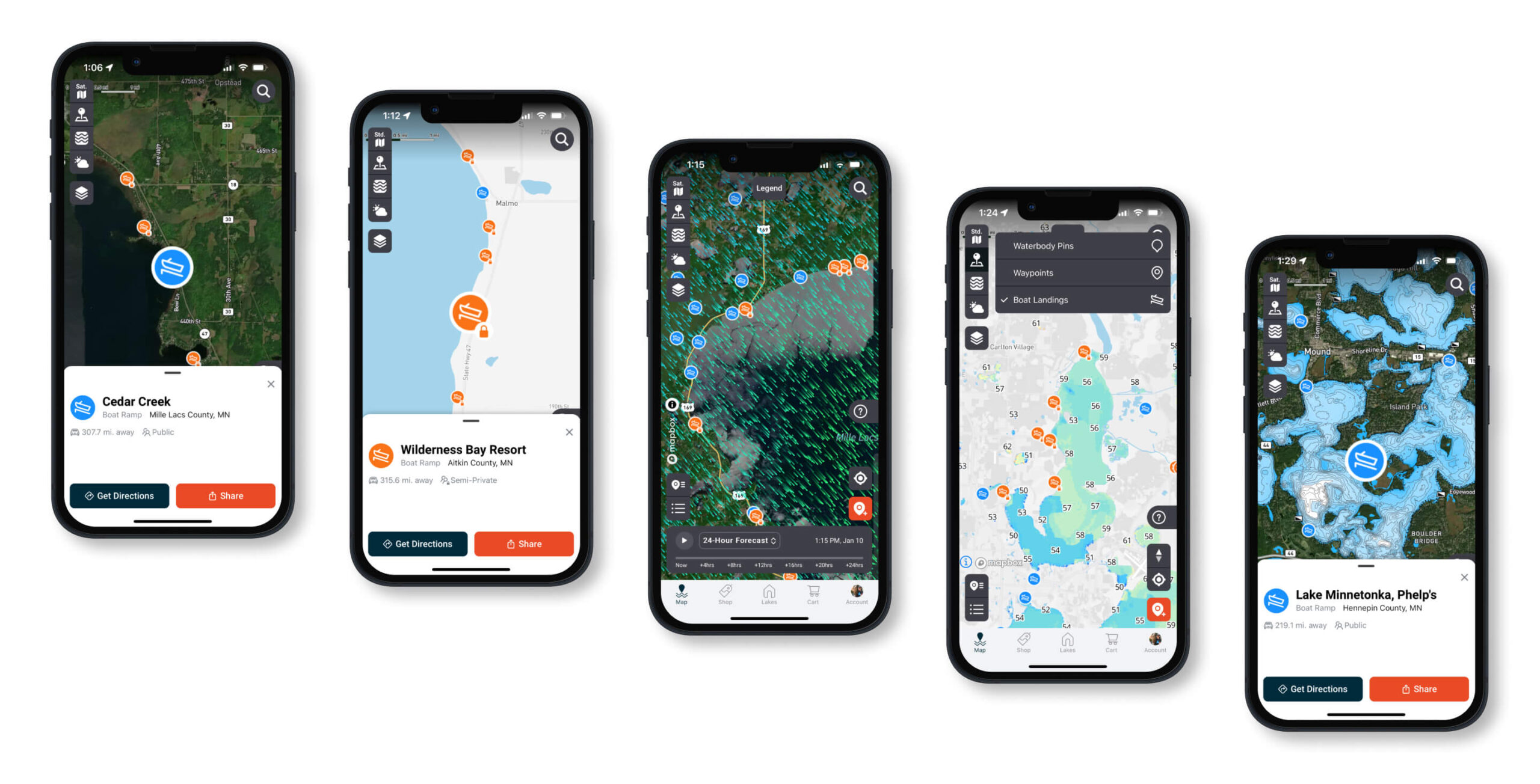
Boat Ramps
With access to thousands of public and private boat ramps across the country, anglers can drill into each ramp location to view detailed information, get directions, or share with others. Beyond basic access, this feature helps users choose the most strategic launch point based on wind direction, weather, and lake conditions—making it easier to start the day in the right spot and maximize time on the water.
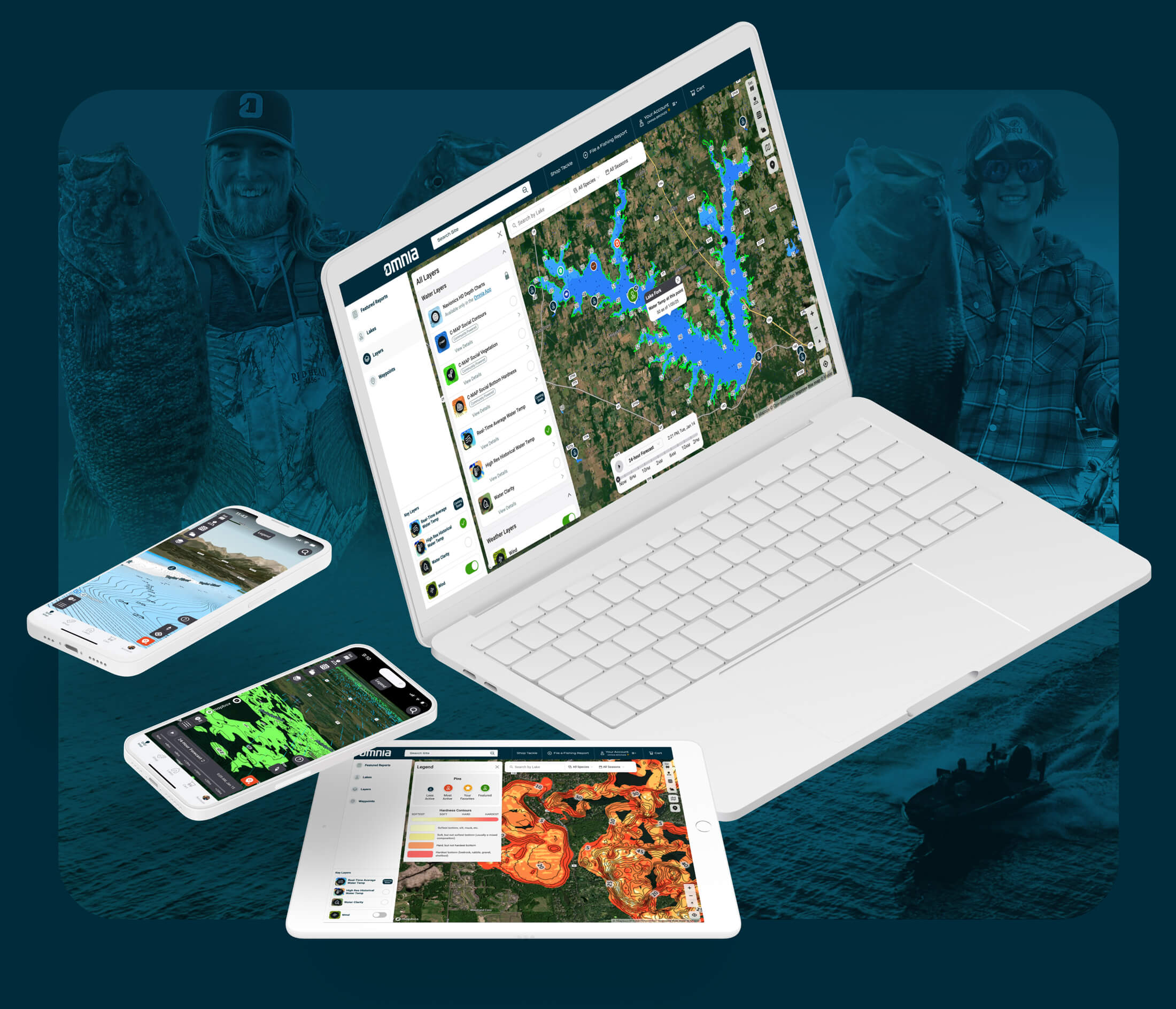
Desktop Application
After refining the mobile app experience, user feedback revealed a strong interest in planning fishing trips from their computer. In response, we designed and built a desktop experience that mirrors the mobile app while taking advantage of larger screens. This gave anglers a more immersive map experience and a convenient way to plan trips in the offseason or from home with greater detail and flexibility.
Access Maps on Desktop, Tablet, or Mobile
In the end, we delivered a cohesive and seamless experience across desktop, tablet, and mobile—giving anglers the ability to plan their fishing trips from any device, anywhere. With full access to lake details, local angler reports, and real-time conditions, users can quickly find the best spots and eliminate dead water for more successful outings.
Final Results
By identifying user needs, executing on designs, and testing / iterating based on user feedback, I played a key role in designing and implementing an excellent Omnia Fishing mapping experience for anglers from all experience levels. We achieved the following:
- 221% Increase in Daily Active Users: The seamless map experience, integrated with Omnia PRO, drove significant subscriber growth—shifting monthly growth from 19% to 40%, then to 221%.
- Increased Revenue: Premium map layers introduced through Omnia PRO created a new revenue stream and strengthened Omnia’s position in the outdoor recreation space.
- Higher Conversion Rate: By segmenting users into beginner, intermediate, and advanced groups, we tailored the experience to guide users toward key actions—boosting conversions.
- Improved User Journey Tracking: The new design allowed for better tracking of user interactions and resource usage throughout the planning process.
- Higher User Engagement: A more immersive experience across mobile and web platforms led to increased user interaction and time spent in the app.
Other Projects
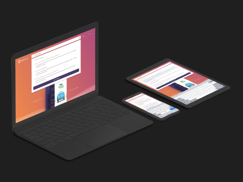
Dwolla Developer Portal RedesignUX / UI Design
Global Search on Dwolla.comUX / UI Design
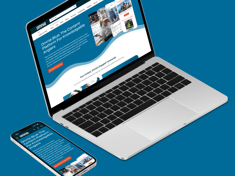
Omnia Blue Landing PageWeb Design
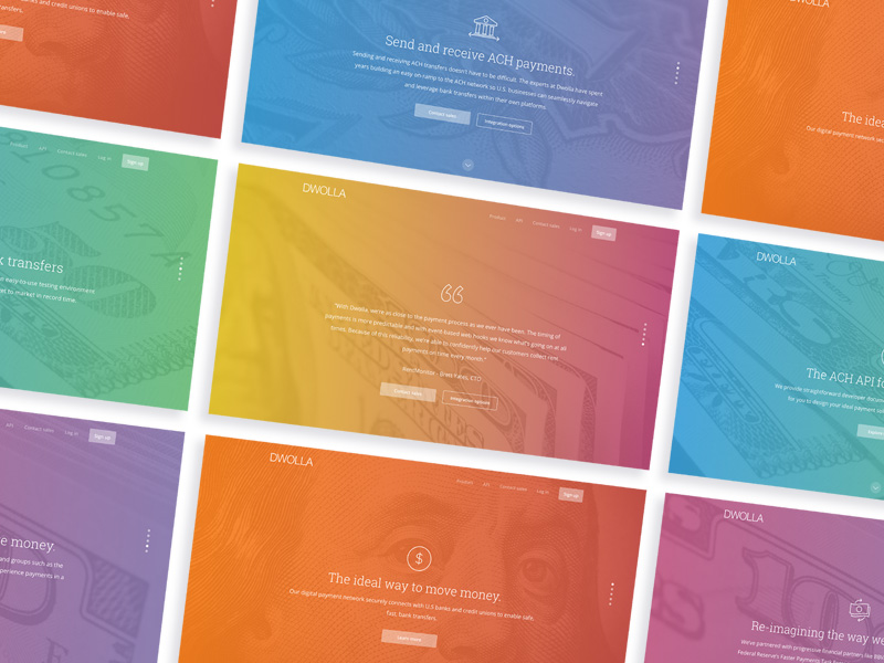
Dwolla Marketing Site RedesignWeb Design
Dwolla Identity Design SystemBranding
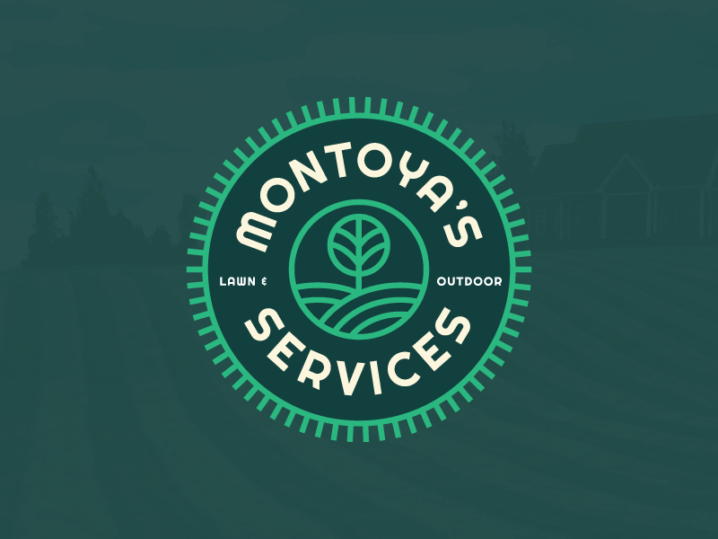
Montoya Lawn & Outdoor ServicesBranding
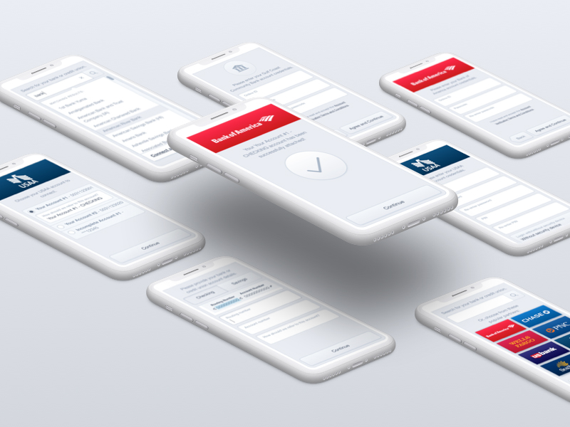
FinTech Product PrototypeUX / UI Design

Dwolla Core ValuesBranding
Landing Page GraphicIllustration
Red Benny Font SpecimenBranding / Typography

Office City Location IllustrationsIllustration
Louis C.K.Illustration
Flat Finance IconsIllustration
Democrat Republican LogoIllustration
Isometric IllustrationsIllustration
Flat Audience IconsIllustration
Dwolla Mission, Visions & ValuesTypography / Print
Food Benefit PosterPrint